

 Shopping cart: 0
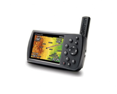

GPSMAP 495 is the best handheld GPS receiver at a best price. Check for the review of its specifications.
Fly with confidence with the best GPS tracking for aircraft, with its enhanced situational awareness and advanced navigation system you can never go wrong with this handheld gps receiver. Navigate by land or sea with this garmin aviation portable.
User feedback: “Along with its excellent GPS tracking for aircraft, it gives access to the topo map in the USA and gives a high resolution aerial photos.”
View Your Position on Taxiways
Garmin SafeTaxi data provides detailed taxiway diagrams and position information for over 850 U.S. airports. Preloaded on the unit, this information helps you navigate unfamiliar airports with confidence and shows your aircraft’s exact position on the field.
Access AOPA Airport Directory
Easily look up taxi services, plan an overnight, choose fuel stops and more with the Aircraft Owners and Pilots Association (AOPA) Airport Directory included on GPSMAP 495. It offers detailed information for over 5,300 U.S. airports along with airports of entry for Canada, Mexico and the Caribbean. It includes the names and phone numbers of thousands of FBOs, plus ground transportation, lodging, restaurants, local attractions and more.
Receive Altitude-Sensitive Alerts
When in the air, Garmin’s Smart Airspace feature makes it easier than ever to identify what airspace lies ahead. Smart Airspace automatically highlights airspace close to your current altitude and de-emphasizes airspace well above or below your altitude, which gives you increased situational awareness.
Enjoy Faster Update Rate
For added realism and safety, the 495 updates map data and "Panel" page instruments at 5 Hz, a significantly faster update rate that gives you a smoother, near “real-time” presentation of your aircraft’s analog indicators, such as the HSI and turn coordinator.
Enhance Situational Awareness
GPSMAP 495 features a built-in Jeppesen database and an Americas, Atlantic or Pacific terrain database. It also includes an obstacles database for the U.S. or Europe. Using this information, the 495 displays your flight route over contour terrain mapping. The higher-resolution terrain database includes over ten times as much data as the 296’s for even more visual reference. With information from the terrain and obstacles databases, the 495 monitors your current position in relation to surrounding terrain to provide alerts. Even customize your own minimum clearance levels to receive terrain cautions. The addition of private airports and heliports to the database provides even more navigation and emergency "nearest" options. Add a Garmin Mode S transponder, and the 495 will display TIS traffic alerts that identify surrounding air traffic.
Navigate by Air, Land or Sea
Simply press a button to switch GPSMAP 495 to automotive or marine mode. The 495 comes with a built-in routable basemap. Add optional MapSource® City Navigator® detailed street maps to receive voice-prompted turn-by-turn directions to addresses and points of interest. For a great day on the water, customize the waterproof 495 with optional BlueChart® marine cartography.


