

 Shopping cart: 0
 |
|
|
Helicopter Synthetic Vision Technology (HSVT) advise to buy only from an authorized dealer.
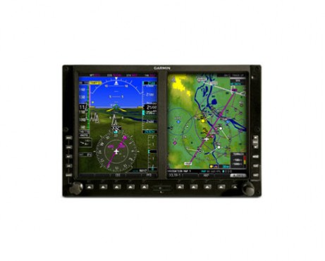
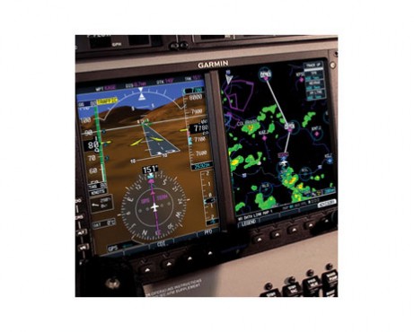
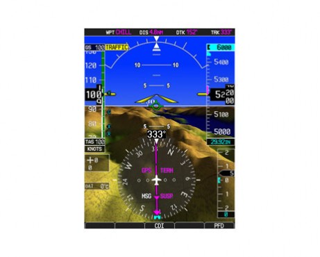
Specially adapted to the needs of helicopter operators, Garmin’s HSVT (Helicopter Synthetic Vision Technology) brings a unique and powerful graphical perspective to “glass cockpit” instrumentation. Available as an option on the G500H, HSVT can make a world of difference when visibility is less than ideal. Using sophisticated computer modeling to recreate a virtual topographic landscape from the system’s terrain database, HSVT gives you a clear depiction of obstacles, traffic, ground and water features, airports and more — all shown in 3-D perspective on the primary flight display.See The Big Picture
Integrated with the G500H’s primary flight display (PFD), Garmin's HSVT is a virtual revolution in situational awareness. Now, instead of a flat blue-over-brown attitude/heading reference, you’ll see an in-depth perspective view of realistic terrain features rising into the sky. It’s like looking through the PFD to monitor your flight situation — without struggling to piece together a mental picture solely from raw instrument data on the panel.
Enhance Your Situational Awareness
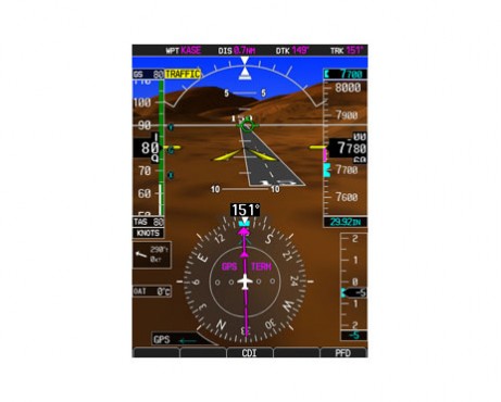
Garmin’s HSVT graphics look so real, it’s almost like having a clear-day “out-the-window” view of your flight situation — even in the darkest nighttime VFR or other low-visibility conditions. Garmin’s HSVT virtual flight reference is like “taking the blinders off.”
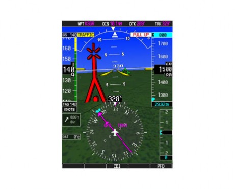
When flying in areas or at altitudes where rising terrain may pose a hazard, Garmin HSVT uses its terrain database to colorize or “paint” the landscape — clearly showing with amber or red overlays those areas where potential flight-into-terrain risks exist. Towers or obstacles that may encroach upon the flight path are color-highlighted and clearly displayed with height-appropriate symbology. HSVT also offers a user-selectable “reduced protection” or “RP” Mode to accommodate low-level operations and minimize hazard alerts.
Garmin HSVT can work with active and passive traffic systems, including Garmin’s GTS™ and GTX 330 Series. With traffic data graphically displayed on the PFD, you can more easily identify other aircraft in front of you — gaining a much clearer picture of your overall flight situation.
Expand Your View
The vision may be synthetic. But the benefits are absolutely real. Although Garmin HSVT is not intended to replace traditional attitude and directional cues as one’s primary flight reference, it clearly augments your view of this data by giving it a realistic visual frame of reference — so you can see at a glance where you are in relation to ground features, traffic, and the flight path entered in your navigation system. Thus, you’re always flying with the future clearly in sight.

")


")