 Shopping cart: 0
|
|
* Weight: 3 lbs.
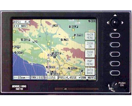
* Screen: 5" color TFT active matrix LCD (76800 pixels)
* Altitude: 35000 ft. max
* Power Input: 10-33 volts DC. 20 watts max
* System Accuracy: Better than 0.124Nm
* Jeppesen Database: ARINC 424 Format VORs, NDBs, airfields, runway information and graphics, comm frequencies, airways and intersections, danger areas and upp/lower controlled airpsace limits
* Routes: Holds up to99 reversible routes, each with up to 99 turning points
* Outputs: TO/FROM Flag, CDI Bar, NAV Flag, NAV Superflag, WPT Annunciator, Message Annunciator, RS232 / NMEA / Wx-500 Stormscope control output and audio annunciator output
* Dimensions: 3.98"H x 6.176"W x 6.425"L
* Cooling: 5V brushless cooling fan
* Temperature: -20 to +70C
* Receiver: 8 channel parallel
* Geographic Database: Coastline, terrain, urban areas, cities, roads, major railway routes, lakes, rivers and obstacles over 500 feet (USA only)
* Waypoints: Holds 500 user defined waypoints and up to 25 user configurable airfields for those not Jeppesen listed
* Inputs: Capable of receiving differential GPS data (RTCM-104 format) and data from a BF Goodrich WX-500 Stormscope sensor
* External GPS: Requires ARNAV R-30 (King) (RS232 or RS422 9600 baud), NMEA0183 (4800 or 9600 baud)
Related goods and services


