 Shopping cart: 0
 |
|
|
Garmin Helicopter Terrain Awareness and Warning System(HTAWS)
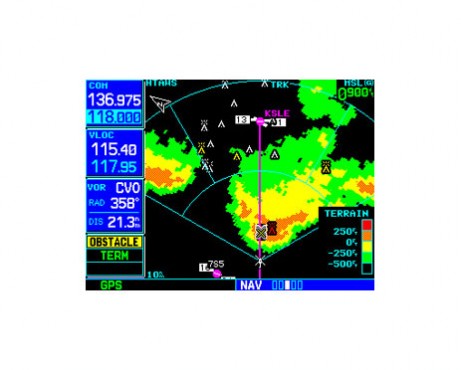
Available as an option on Garmin’s GNS 430W and 530W series navigators, Garmin's HTAWS (Helicopter Terrain Awareness and Warning System) offers “forward looking” terrain and obstacle avoidance (FLTA) capability to alert in advance where potential hazards may exist.Maintain Safe Separation
Providing visual and aural advisories to help keep pilots safely separated from hazardous terrain, this TSO-C194-approved technology is engineered specifically for helicopter mission profiles. WAAS GPS position information is compared with the GNS 430W/530W units’ internal terrain/obstacles databases to determine conflict scenarios. If your helicopter has inadequate terrain and/or obstacle clearance ahead, based on the system’s projected flight path, HTAWS caution and warning alerts are issued to you. Accompanying FLTA voice alerts also indicate the relative threat level.
No Mistaking The Voice
In addition to terrain and obstacle alerting, Garmin’s HTAWS system also features voice callouts, or VCOs, which audibly announce the helicopter’s height above terrain when descending below 500 feet. VCO altitude callouts operate in all HTAWS modes, and Garmin’s technology allows you to select multiple callouts, in one hundred foot intervals, descending from 500 down to 100 feet.
Add Options
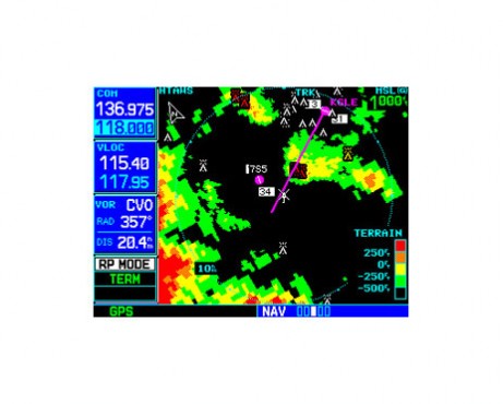
To minimize “nuisance” alerts, Garmin's HTAWS offers pilot-selectable options to: 1) suppress an active audible caution alert (while still displaying visual annunciations), or 2) use a “reduced protection” or “RP” Mode, which allows for low-level operations and off-airport landings with reduced alerting, while continuing to provide protection from terrain and obstacles.
A third option inhibits HTAWS alerting altogether – but still allows voice callouts to audibly annunciate the aircraft’s height above terrain when descending to 500 feet or below. Garmin developed a special helicopter obstacle database for its HTAWS option containing nearly 30,000 more structures, obstacles and oil rigs than the Garmin fixed-wing aviation versions and enabling the system to depict some 25 percent more obstacles that might pose a hazard to helicopter operations.
Upgrade Easily
Customers with existing GNS 430W/530W series navigators may opt to easily upgrade their units with HTAWS capability by taking it to an Authorized Garmin Service Center for an on-site upgrade.


